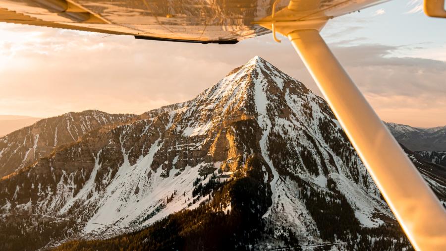
How Tall is Mount Timpanogos?
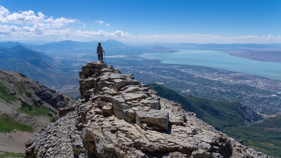
Standing at an impressive height of 11,753 feet (3,582 meters), Mount Timpanogos is the second-highest peak in the Wasatch Range. Its majestic presence dominates the landscape, providing hikers with awe-inspiring vistas of the surrounding valleys and mountain ranges.
How Long Does It Take to Hike Mount Timpanogos?
The duration of the hike can vary depending on your pace and level of fitness. On average, hikers complete the hike in 8-12 hours. This includes time to take breaks, appreciate the scenery, and celebrate the summit.
How Many Miles is the Mount Timpanogos Hike?
There are two trails to reach Mount Timpanogos. Both trails are approximately 14 miles round trip. From the Aspen Grove Trailhead, Mount Timpanogos is a 13.9-mile hike. The Timpooneke Trail covers a similar distance of 14.3 miles.
Where is Mount Timpanogos?
Mount Timpanogos is located in the Wasatch Mountains of northern Utah, within the Uinta-Wasatch-Cache National Forest. It is approximately 50 miles (80 kilometers) south of Salt Lake City. The mountain is close to Provo Canyon and American Fork Canyon. This makes it a popular spot for both locals and tourists.
Mount Timpanogos Map
How Did Mount Timpanogos Get Its Name?
The name "Timpanogots" is derived from the Native American tribe that inhabited the region, known as the Timpanogos Utes. The name is believed to have originated from their language and loosely translates to "rock” (tumpi-), and “Water Mouth” (panogos).
The Timpanogos Utes held Timpanogos Mountain in high reverence. Legends and stories of the mountain passed through generations, adding to its captivating allure.
How Long is the Hike to Timpanogos Cave?
If you're interested in exploring Timpanogos Cave National Monument, it is a separate adventure from hiking to Mount Timpanogos summit. This is a fascinating experience worth exploring. The hike to Timpanogos Cave starts near the visitor center and is approximately 1.5 miles (2.4 kilometers) long. Plan for 3-4 hours for the cave tour and hike.
Route 1: Timpooneke Trail
- 14.3 Miles round trip
- 4,448 ft Elevation Gain
- 1 Waterfall
- Timpooneke Road, Provo, UT 84604
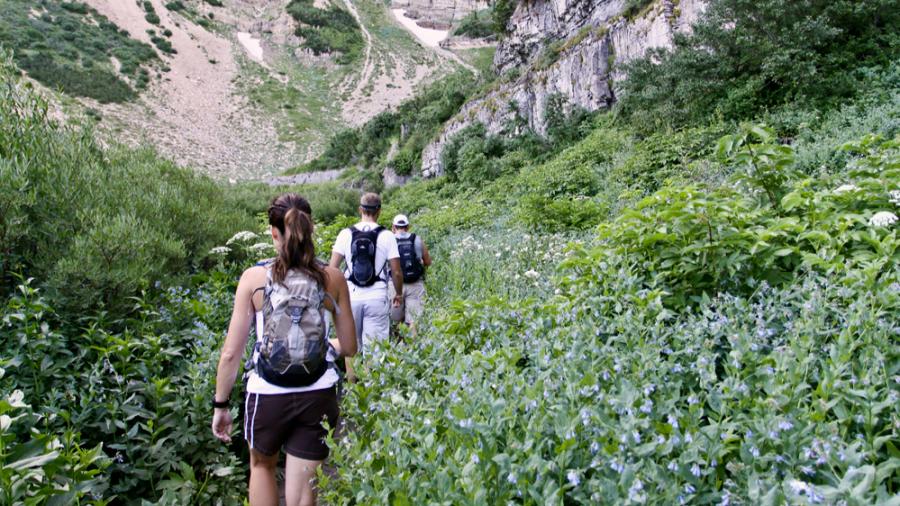
If you're seeking a longer but more leisurely hike up Mt Timpanogos, the Timpooneke Trail is your best bet. This trail starts at the Timpooneke Campground in American Fork Canyon. It offers a gradual incline and has a good balance between steep sections and open fields.
Along the way, you'll find yourself immersed in a lush, shaded environment surrounded by abundant wildlife and vibrant wildflowers. The trail has water for the first two miles. After passing Scout Falls, you must take your own water with you.
Note that the Forest Service does require an $8 parking permit at the Timpooneke trailhead on peak days: Fridays, Saturdays, and holidays from midnight to 1:00 pm. If you plan on hiking any of these days, you must secure a permit in advance by clicking here.
- Managed parking during peak season, days and hour is being implemented to improve visitor experience:
- Securing a permit in advance online at Recreation.gov or by phone will ensure your access to Timpooneke trailhead for your specific day.
- Permits are required on peak days, Fridays, Saturdays, and holidays from midnight to 1:00 pm, which will help reduce congestion in the parking area. Example: Friday night 12:00 am to Saturday 1:00 pm. Saturday night 12:00 am to Sunday 1:00 pm.
- Cost for the permit is the existing day use fee of $6.00, plus $2.00 non-refundable reservation fee.
The trail is well-marked and maintained, but it's always a good idea to carry a map, compass, or GPS. Occasionally, there are forks in the trail, so using these tools can be helpful.
Keep in mind that parking can be a challenge, especially on weekends. Arriving early in the morning is highly recommended to secure a spot.
Route 2: Aspen Grove Trailhead
- 13.9 Miles round trip
- 4,875 ft Elevation Gain
- 2 Waterfalls, 2 Lakes
- Provo Canyon Road, Provo, UT 84604
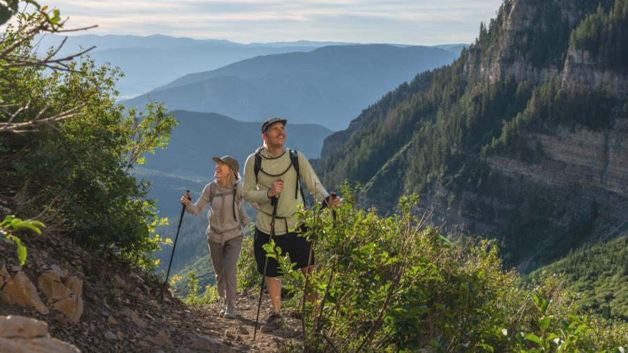
If you're up for a slightly more challenging trek, take the Aspen Grove Trail. This route, starting from Provo Canyon, is shorter in distance but steeper in elevation gain.
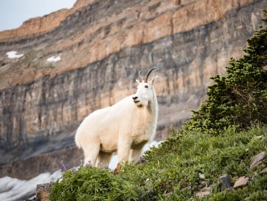
Prepare yourself for jaw-dropping views and magnificent waterfalls. You'll also visit Emerald Lake, a hidden gem nestled along the meadow below the summit. You can also find herds of mountain goats drinking from the streams and hanging around Emerald Lake.
You'll encounter the snowfield, often referred to as the glacier, which can be slippery to navigate. Take caution and consider using trekking poles or microspikes for added stability.
Just after Emerald Lake, the trail merges with the Timpooneke Trail, leading you to the Timpanogos saddle.
The Aspen Grove Trail is well-marked and well-maintained, like the Timpooneke Trail. However, it is still recommended to carry a map, compass, or GPS.
Water at Emerald Lake and Timpanogos Falls serves as a reliable water source, but remember to filter it before drinking.
Best Time to Hike Mt Timpanogos
The ideal time to hike Mount Timpanogos largely depends on the snow melt, which affects trail conditions and accessibility.
Generally, the best months to plan your hike are July and August. During this period, the weather is typically more favorable, and the trail is well-defined.
Opt for hiking on weekdays if possible. This will help avoid the crowds that usually gather on weekends and give you a more serene and enjoyable experience.
Mount Timpanogos Packing List
Navigation
A detailed map of the Mount Timpanogos area and a compass are essential tools for navigation. You won’t have service throughout much of the hike so make sure you don't rely solely on your phone.
Familiarize yourself with the trail routes and potential landmarks before embarking on your journey. It may be a good idea to bring a GPS, especially if it’s your first time summiting Mount Timpanogos.
Extra Water
Staying hydrated is crucial during any hike, especially when tackling higher altitudes. Carry an ample supply of water, as water sources along the trail may be limited. (Especially if you take the Timpooneke Trail).
Consider using a hydration pack or bringing a water filtration device.
Extra Clothes
No matter how warm it is in the valley, the summit of Timpanogos is always windy and cold. Dressing in layers allows you to adapt to temperature fluctuations.
Bring a waterproof and wind-resistant outer layer, as well as moisture-wicking clothing to keep you dry and comfortable.
Extra Food
Packing high-energy snacks and meals is vital to sustaining your energy levels throughout the hike. Opt for lightweight, non-perishable options such as trail mix, energy bars, and dehydrated meals. Remember to bring enough food to last the duration of your hike.
First Aid
Accidents can happen, so it's essential to carry a well-stocked first aid kit. Include basic items such as adhesive bandages, antiseptic wipes, pain relievers, and any personal medications you may need.
Sun Protection
Mount Timpanogos offers little shade along the trail, making sun protection crucial. Bring sunscreen with a high SPF, a hat, and sunglasses to shield your skin and eyes from the sun's harmful rays.
Illumination
It's advisable to carry a reliable headlamp or flashlight, even if you plan to finish your hike before dark. If you start the hike in the wee hours of the morning, you’ll also need a flashlight to navigate the trails.
Additional Tips
Be Aware of Altitude Sickness
Mount Timpanogos reaches above 11,000 feet, and altitude sickness can affect even experienced hikers.
Symptoms may include headache, dizziness, nausea, and fatigue. To mitigate the risk, acclimatize gradually by spending a day or two at higher elevations before attempting the summit.
Stay well-hydrated and listen to your body. If symptoms worsen, descend to a lower elevation immediately.
Avoid Thunderstorms
Mount Timpanogos is the second-highest peak on the Wasatch Front. Once you reach the saddle, the ridgeline is completely exposed.
Check the weather forecast before heading out and be prepared to turn back or take shelter if thunderstorms roll in.
Timpanogos Hiking Co.
Named after this iconic peak, Timpanogos Hiking Co. is the perfect place to grab some swag. If you take a photo at the top of Timpanogos, you can also grab an official badge for climbing the peak.
Get the Mount Timpanogos Hiking Badge Here
Mount Timpanogos Themed Chocolate

When you're done with your hike, don't forget to stop by Taste Chocolates to try their Mount Timpanogos Honeycomb Chocolate!
