Utah County is famous for its stunning mountain backdrops and outdoor adventures, but most visitors stick to the well-worn trails. Tucked away in the Wasatch Range and Uinta foothills are shimmering alpine lakes, steaming hot springs, and quiet forest retreats that most people drive right past. Whether you're a seasoned hiker or just looking for a new weekend spot, these hidden gems are worth every step.
Payson Lakes
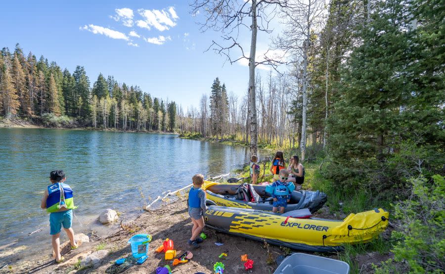
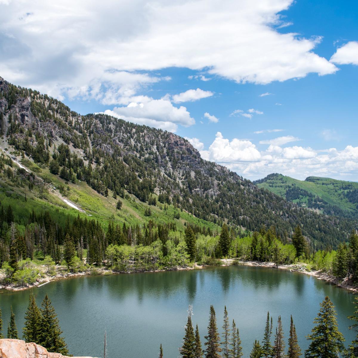
The Payson Lakes area is one of the most family-friendly and underappreciated destinations in the county. There are three lakes, Big East Reservoir, McClellan Lake, and Box Lake, and a paved one-mile loop trail circles the largest, Big East Reservoir, with only 26 feet of elevation gain. It's a genuinely easy outing suitable for all ages, strollers, and leashed dogs. The area is excellent for kayaking, paddleboarding, fishing, and camping, and it sits along the scenic Nebo Loop. The season runs from roughly May through October, and a $10 day-use pass per vehicle is required. Loafer Mountain, visible in the background, offers a longer challenge for those who want more miles after the lake walk.
Distance: 1-mile loop around Big East Reservoir Elevation Gain: 26 feet Difficulty: Easy
Silver Flat Reservoir
Tucked up in American Fork Canyon, Silver Flat Reservoir is a gem that rewards visitors with both easy access and stunning views. There's a paved trail around the lake through aspens and pines, about one mile and very easy, but there's also the Silver Flat Lake Trail starting at Tibble Fork Reservoir that covers 3.6 miles at a moderate difficulty. The reservoir is stocked with brook trout, rainbow trout, arctic grayling, and cutthroat trout, making it a favorite for anglers. The area can be 20 degrees cooler than the valley even in midsummer, so come prepared for any weather. Note that a $10 vehicle day-use pass is required, and the last few miles to the reservoir are on a dirt road where higher clearance is preferred.
Distance: 1 mile (easy loop around the lake) or 3.6 miles from Tibble Fork Trailhead Elevation Gain: 28 feet (loop) or 1,122 feet (from Tibble Fork) Difficulty: Easy to moderate
Fifth Water Hot Springs
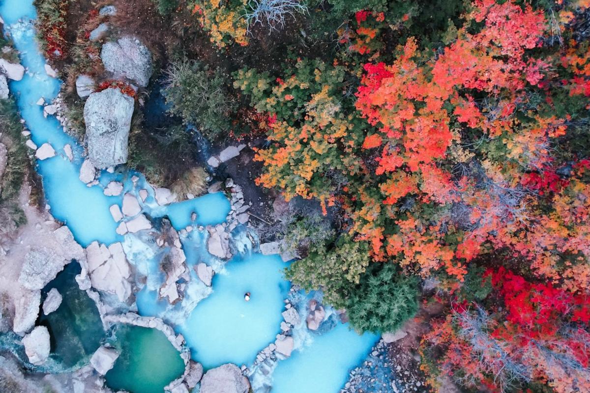
If there's one spot on this list that has earned a cult following, it's Fifth Water. Also known as Diamond Fork Hot Springs, the trail is 2.5 miles each way through a forested canyon, with pool temperatures ranging up to 108 degrees. The upper pools are the hottest. As you follow the trail along Sixth Water Creek, the water gradually turns milky blue and you'll start to catch the scent of sulfur, which is the sign you're getting close. In late fall through spring, the road closes and the round trip stretches to about 7.5 miles with the additional road walking. Fall is widely considered the best season to visit. The canyon turns golden, the crowds thin out, and soaking in warm mineral water surrounded by autumn leaves is an experience you won't soon forget. A $10 parking fee applies.
Distance: 4.5 miles round trip (summer) / 7.5 miles round trip (when road is closed in fall-spring) Elevation Gain: ~636 feet Difficulty: Moderate
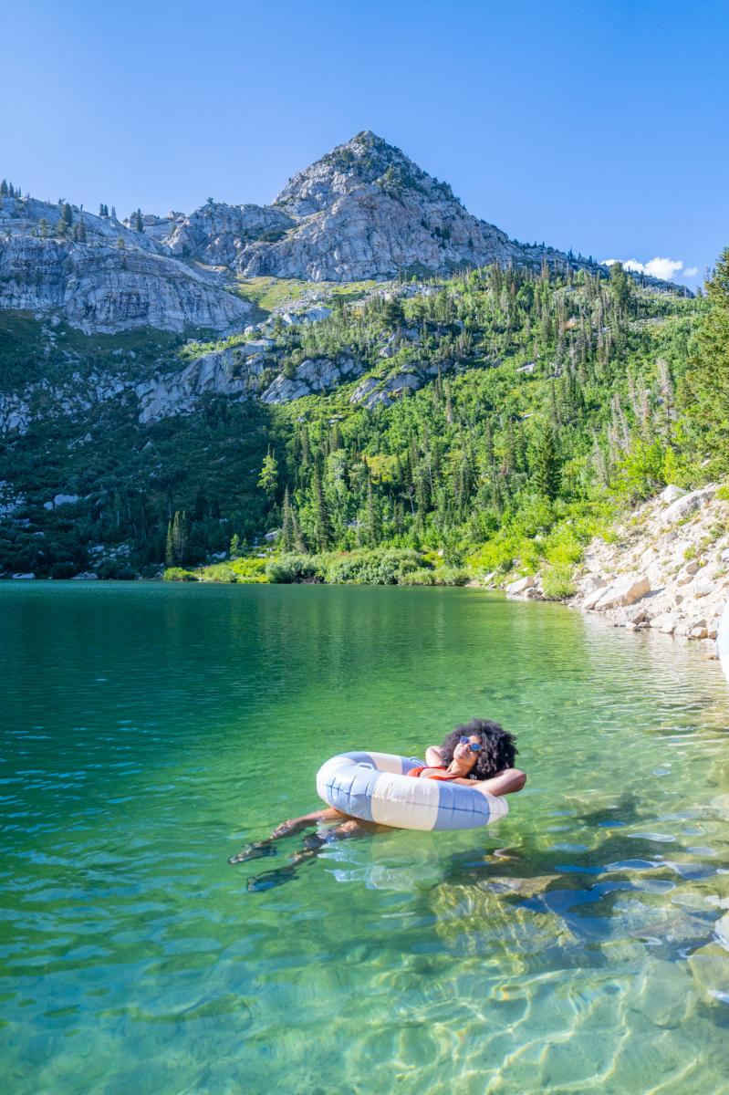
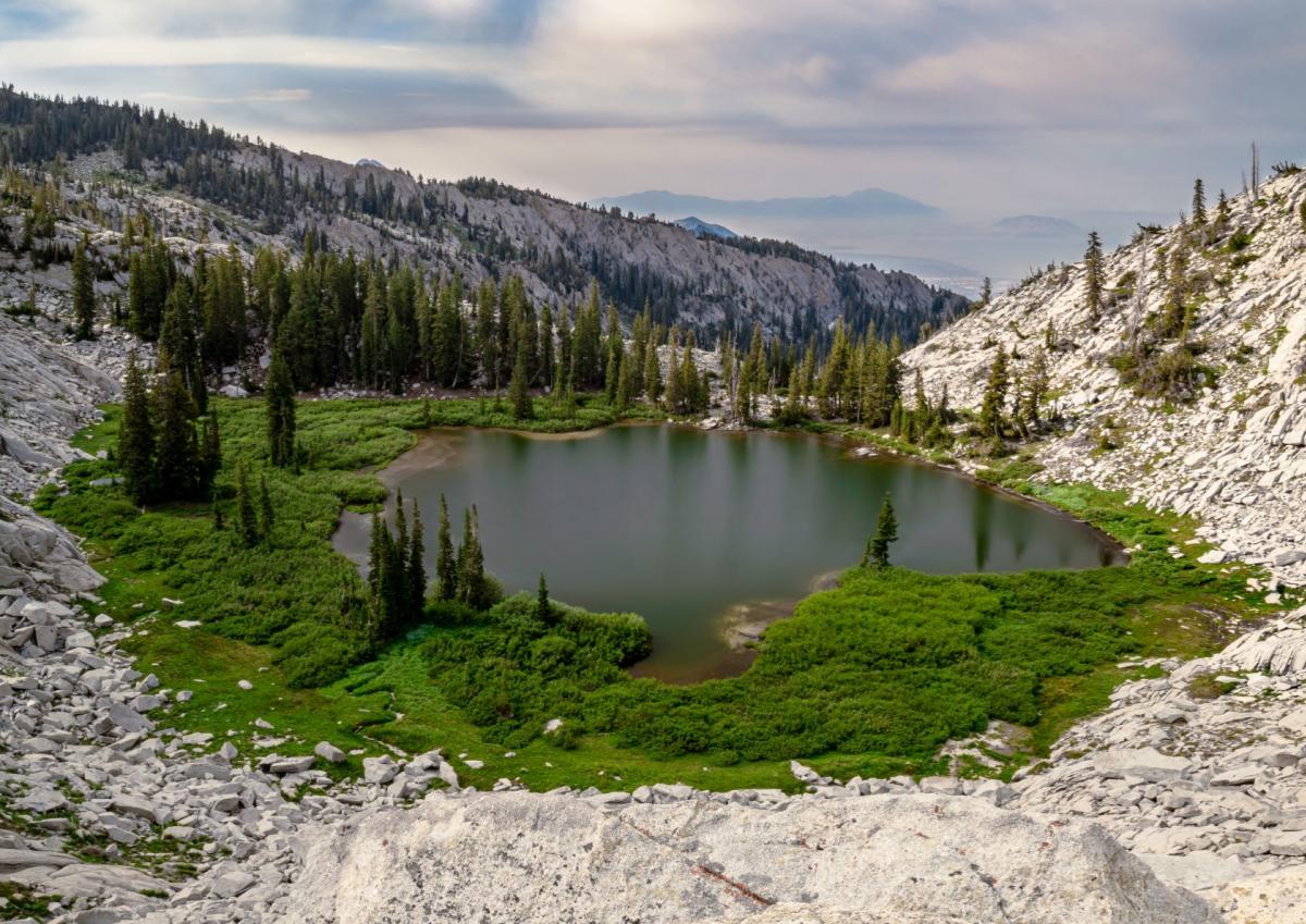
Silver Lake
Silver Lake, near Tibble Fork in American Fork Canyon, sits in the shadow of some of the most dramatic and rugged peaks in the Wasatch. The hike is 4.7 miles round trip with about 1,433 feet of elevation gain, rated moderate, with a well-maintained trail of dirt and rocks. The lake sits at 9,000 feet and is surrounded by towering granite cliffs that make the setting feel genuinely remote despite the relatively short drive from the valley. Restrooms are available at the trailhead, dogs are welcome on a leash, and the season runs from roughly April through October. A $10 vehicle pass is required to enter American Fork Canyon.
Distance: 4.7 miles round trip Elevation Gain: 1,433 feet Difficulty: Moderate
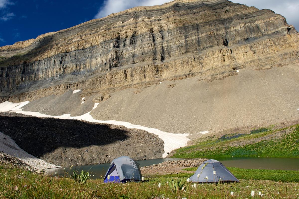
Pitsburg Lake
Remote, rocky, and rarely crowded, Pitsburg Lake sits on the backside of the Snowbird ski area in American Fork Canyon and has a rugged, old-world character all its own. The trail is 3.4 miles out and back with 1,558 feet of elevation gain and takes most hikers about 2.5 to 3 hours to complete. Getting to the trailhead requires several miles of rough dirt road, and a high-clearance vehicle is strongly recommended as there are stream crossings involved. The hike itself is a steady grade with a few rocky scrambles near the top, and the lake holds small brook trout and has several good spots to camp. An old historic mining cabin sits near the lake and is worth exploring. Best visited June through October.
Distance: 3.4 miles out and back Elevation Gain: 1,558 feet Difficulty: Moderate to hard
Emerald Lake
Emerald Lake is fed by the permanent snowfield near the summit of Mount Timpanogos and is accessible via the trail from the Aspen Grove Trailhead near Sundance Resort. The hike is 10.3 miles round trip with 3,467 feet of elevation gain, rated difficult, and accessible roughly June through October due to deep snow. The trail is known for its series of stunning waterfalls, with more than a dozen on the way up, as well as mountain goats that frequently graze near the lake. The lake sits at 10,397 feet, nestled in a glacial cirque at the base of Timpanogos near-vertical northeast face. Start early, bring plenty of water, and plan for six or more hours on the trail. A $6 fee is paid at the ranger booth, or a National Parks pass is honored.
Distance: 10.3 miles round trip Elevation Gain: 3,467 feet Difficulty: Difficult
Lake Hardy
Nestled deep in the Lone Peak Wilderness above Alpine, Lake Hardy is a serious undertaking that rewards those willing to earn it. The most common route is about 9.8 miles out and back from the Schoolhouse Springs Trailhead, with a grueling elevation gain that will test even experienced hikers. The trail is notoriously overgrown and difficult to follow in spots, with rugged and sandy terrain, so be prepared with long pants and long sleeves and download an offline map beforehand. The best time to visit is May through September. What you'll find at the top is a pristine alpine lake tucked into a granite bowl beneath Big Horn Peak, and it makes every hard-fought step worth it. Plan for a full day.
Distance: 9.8 miles out and back Elevation Gain: ~4,400 feet Difficulty: Very difficult
A Few Tips Before You Go
Utah County's mountain trails are generally accessible from late spring through early fall, with higher elevation lakes often snowbound well into June. Most of the American Fork Canyon destinations require a $10 vehicle day-use pass, and a National Parks pass covers this fee, making it a great investment if you plan to visit multiple times. Always check trail conditions before heading out, download offline maps since cell service is spotty in most canyons, pack plenty of water, and let someone know your plans. The Wasatch Range changes weather fast, and afternoon thunderstorms are common in summer.
These lakes and springs may be hidden, but the experiences they offer are anything but ordinary. Get out there and find your favorite.
